

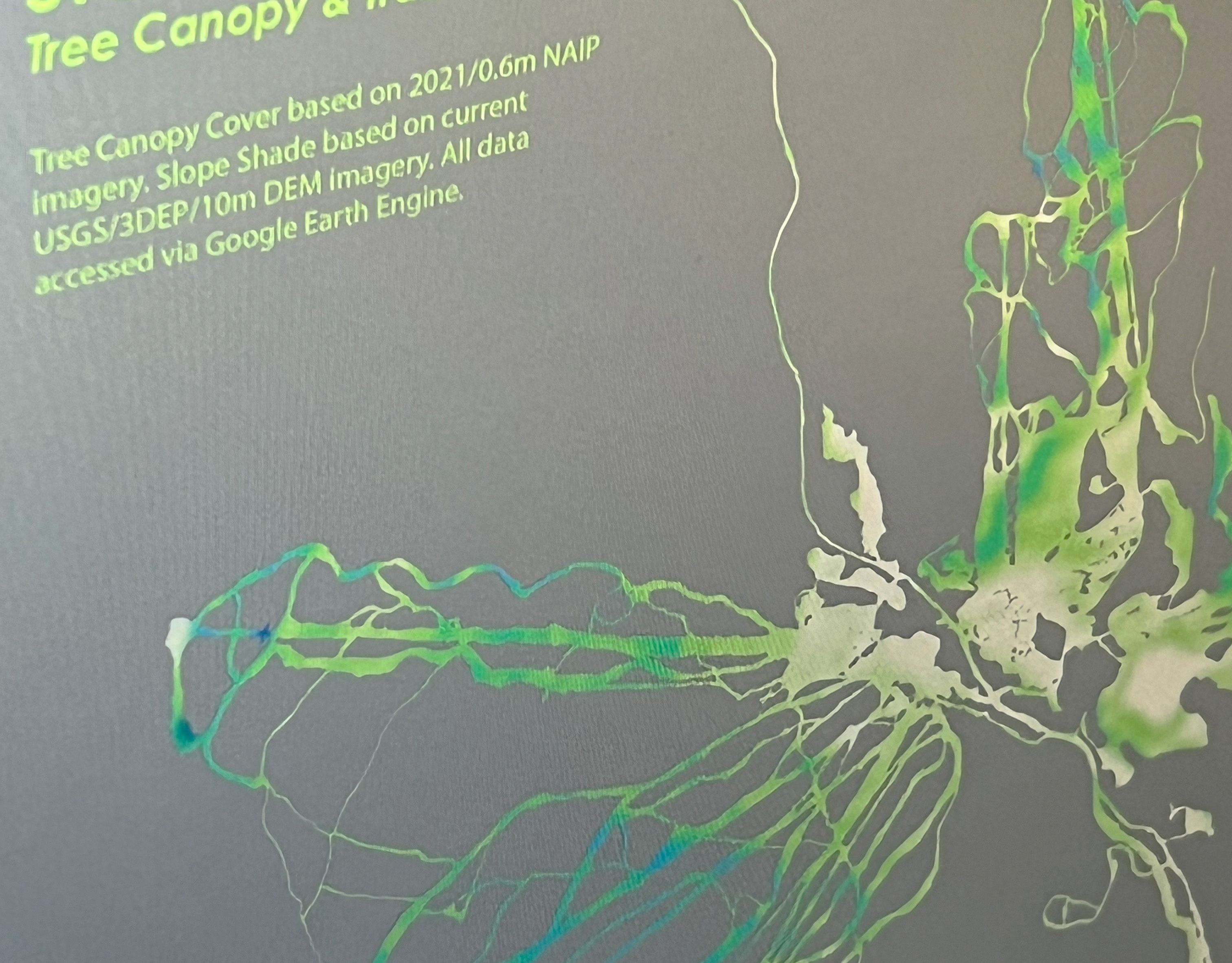
Stowe VT Tree Canopy Cover
Remote Sensing, Cartography
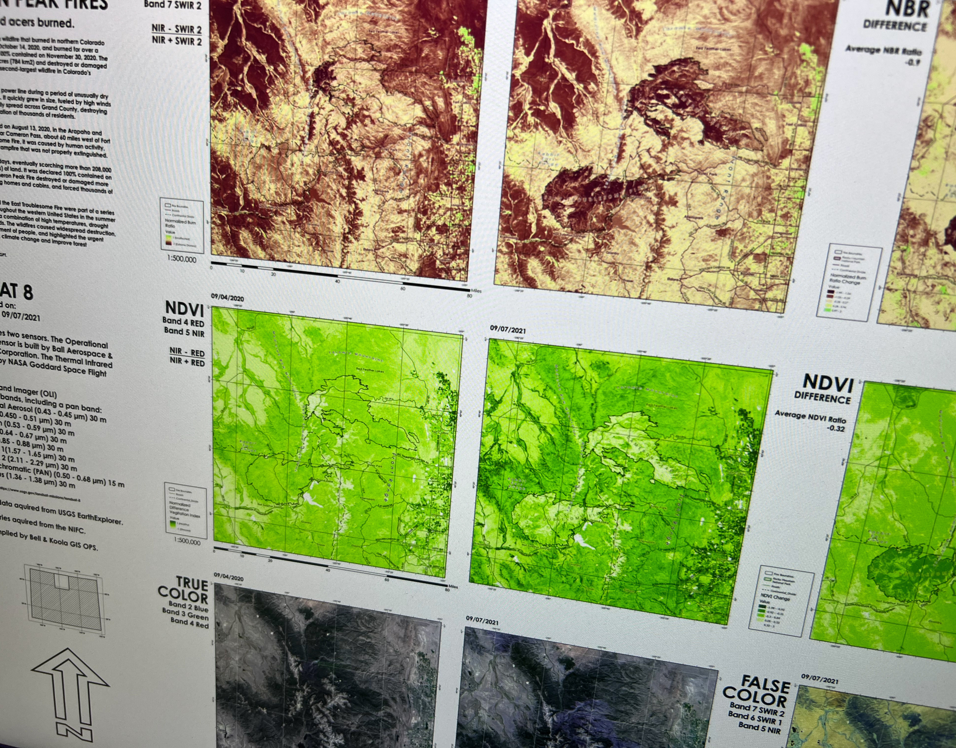
East Troublesome & Cameron Peak fires
Remote Sensing, Cartography
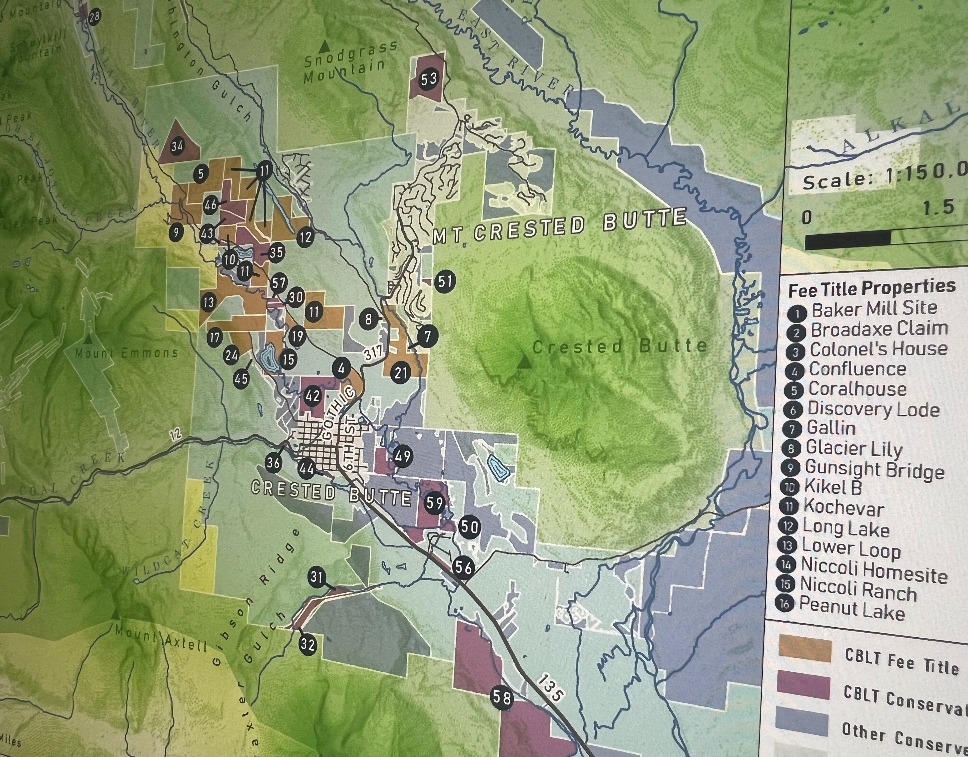
Crested Butte Land Trust
Cartography
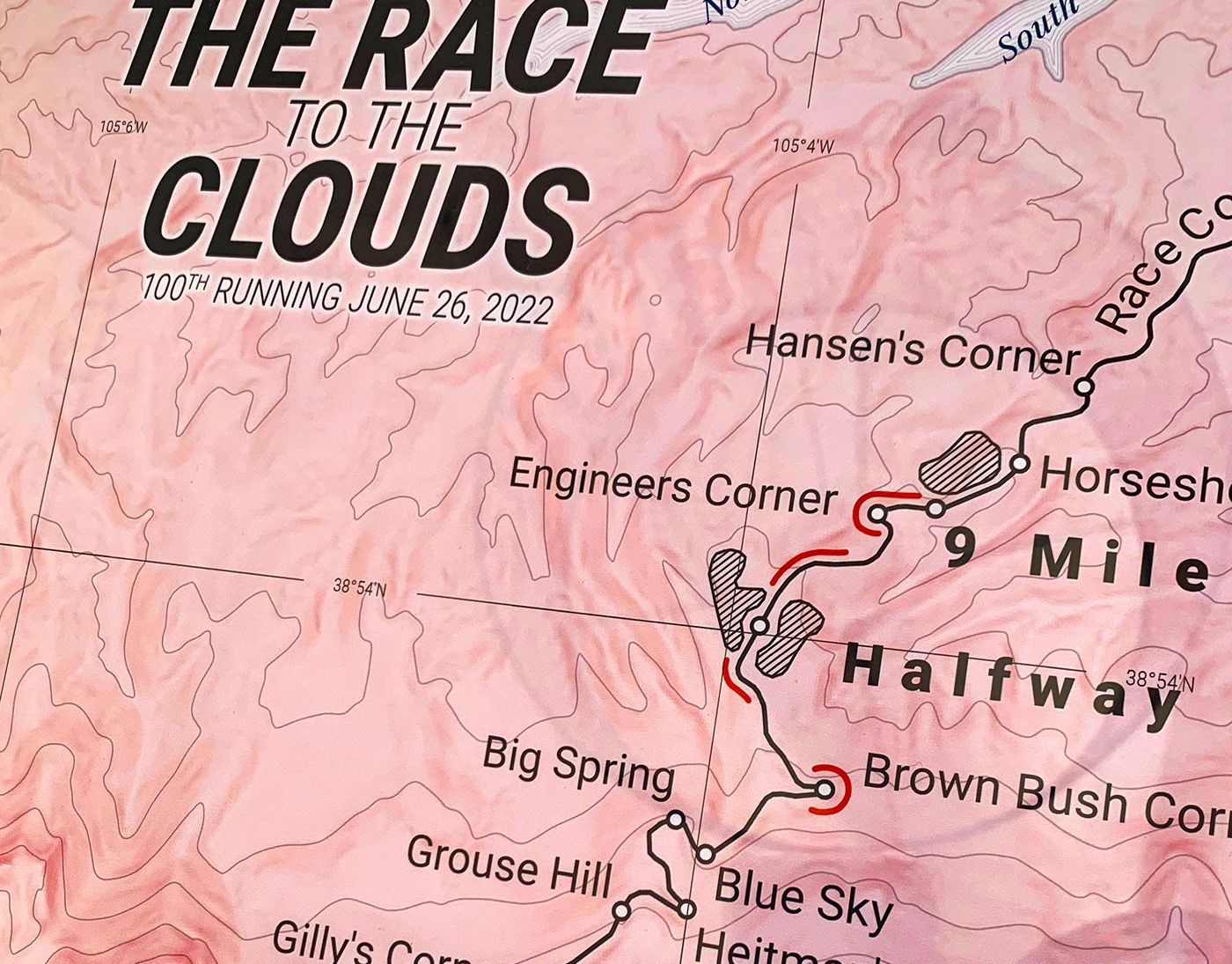
The Race to the Cloud / Award Winner*
Cartography
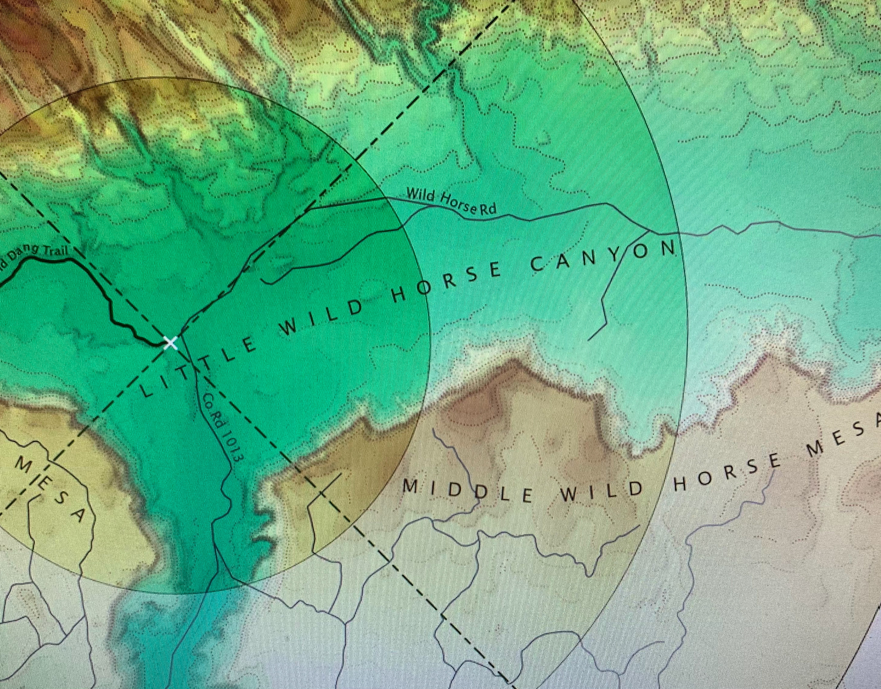
Ding & Dang
Cartography
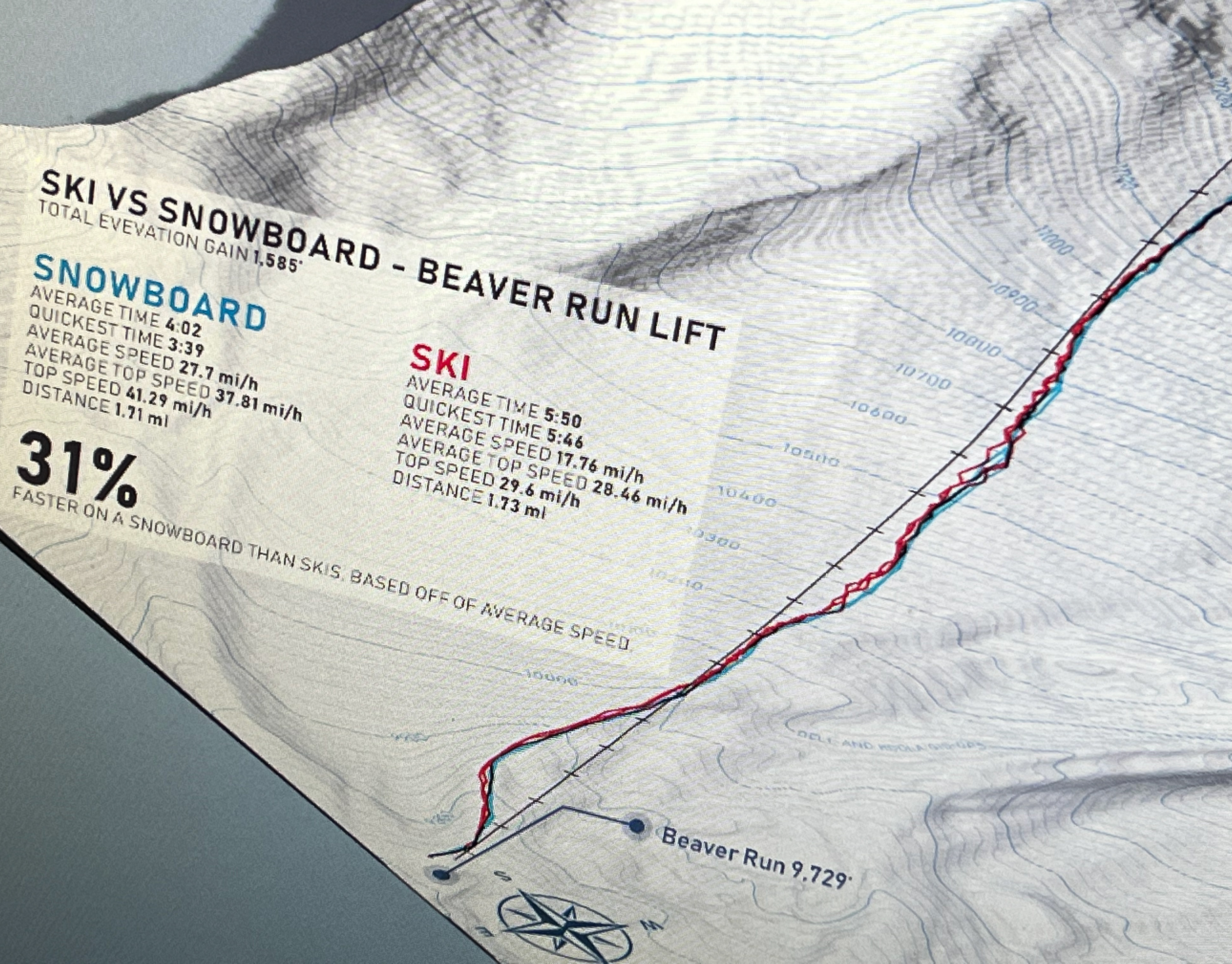
Ski Vs Snowboard
Cartography, Data Capture
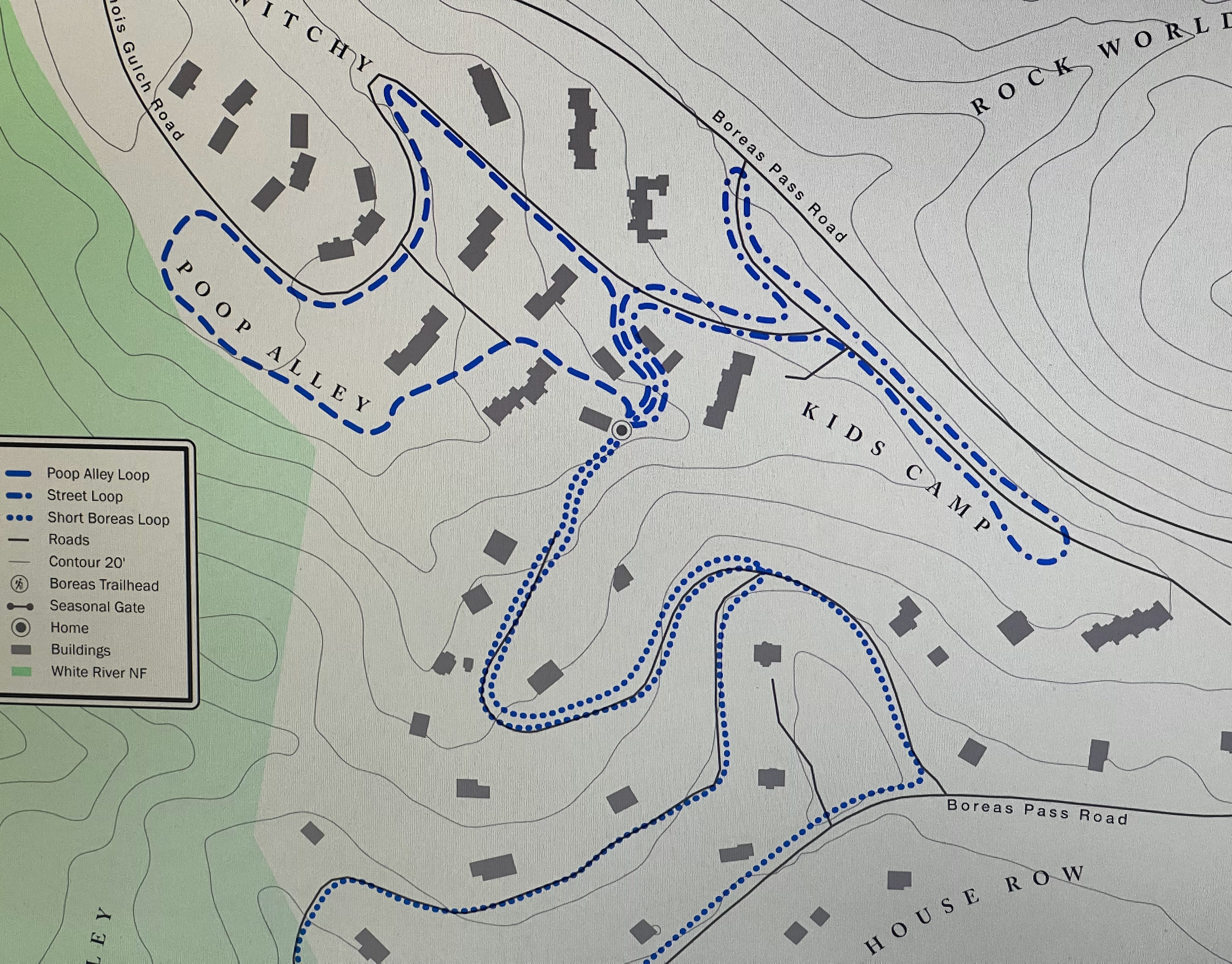
Rileys Main Walks
Cartography, Data Capture
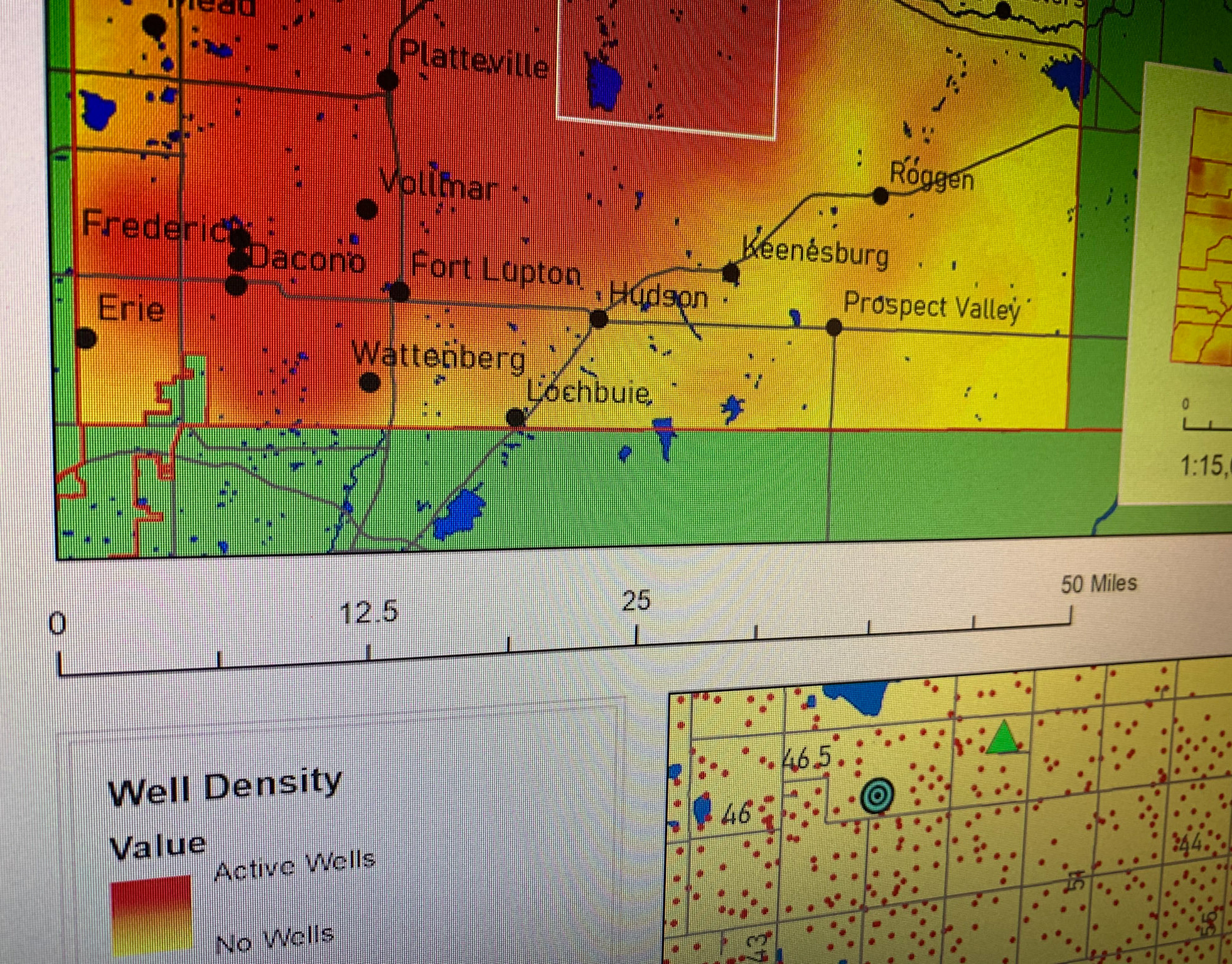
Oil & Gas Surface Well Density in Weld County Colorado
Geo Analysis & Cartography
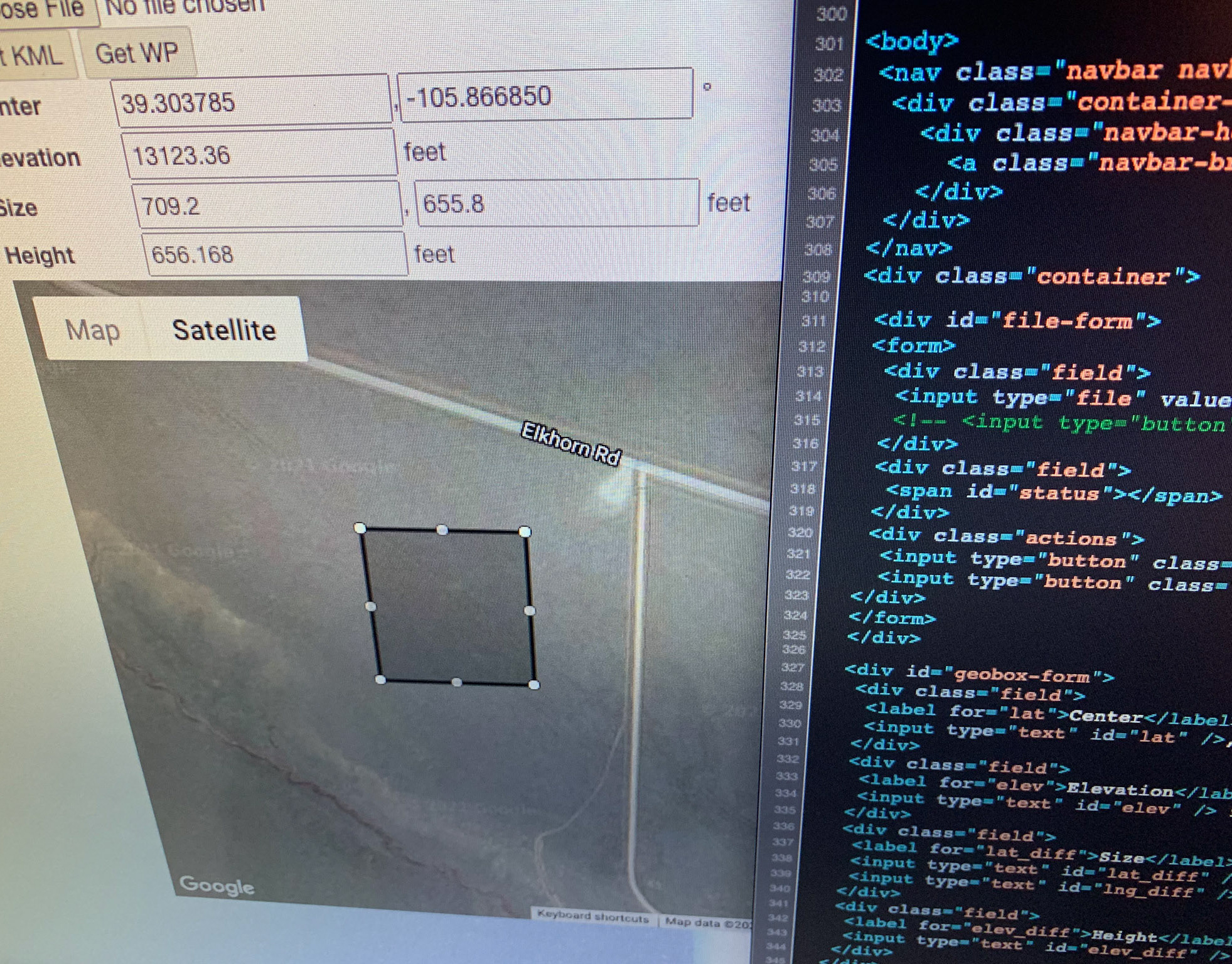
La Machine
Web Based GIS Tool
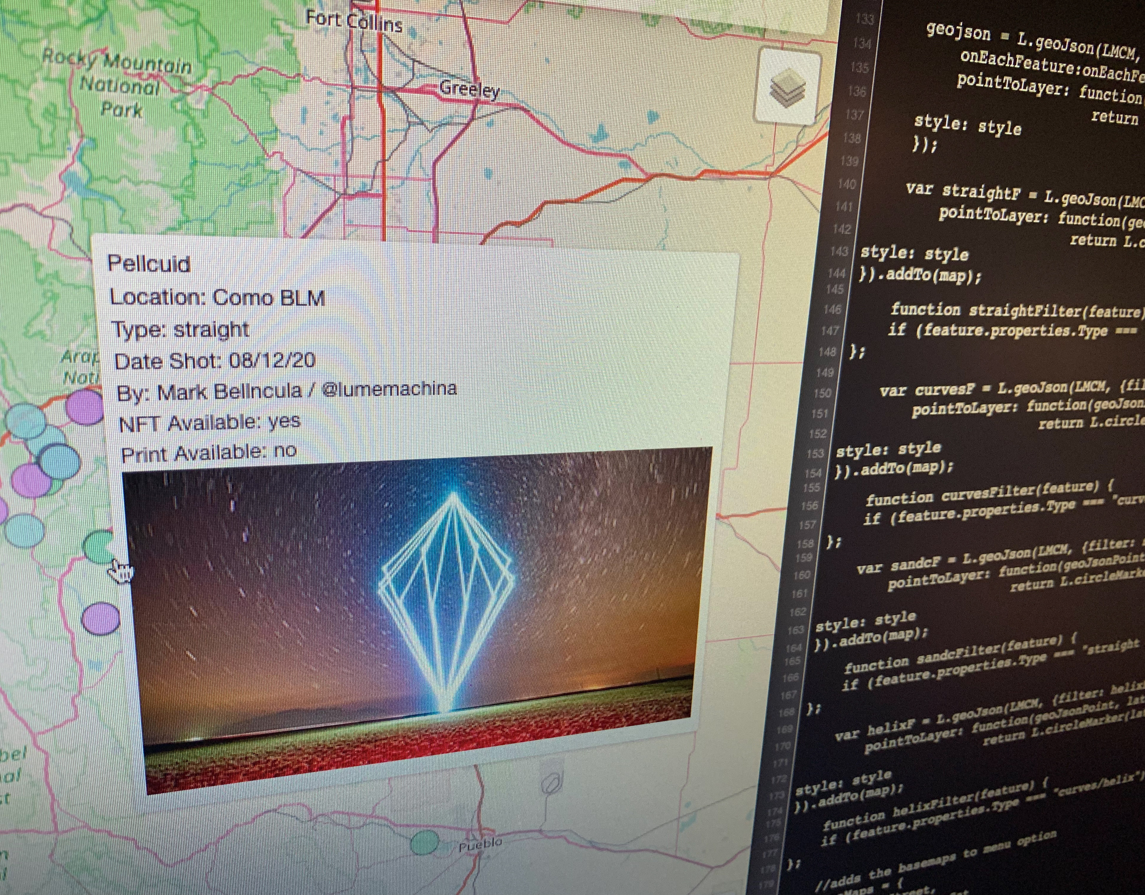
Lume Machina Completed Works Map
Leaflet Map
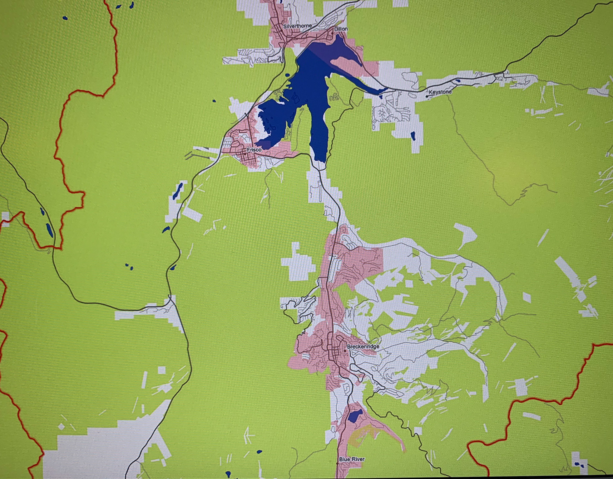
Colorado Public Lands and Controlled Airspace
Cartography
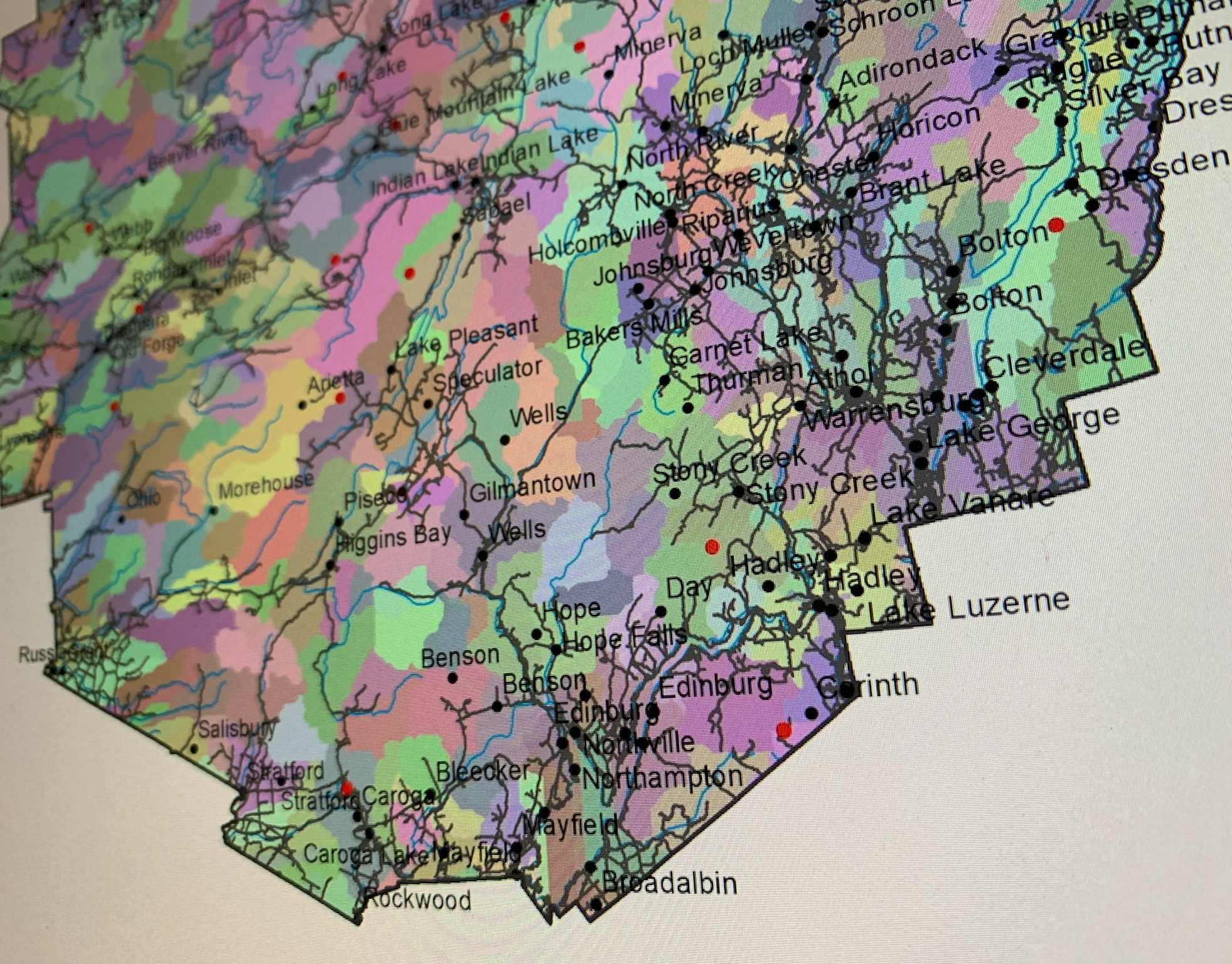
Adirondack National Park Watersheds
Geo Analysis