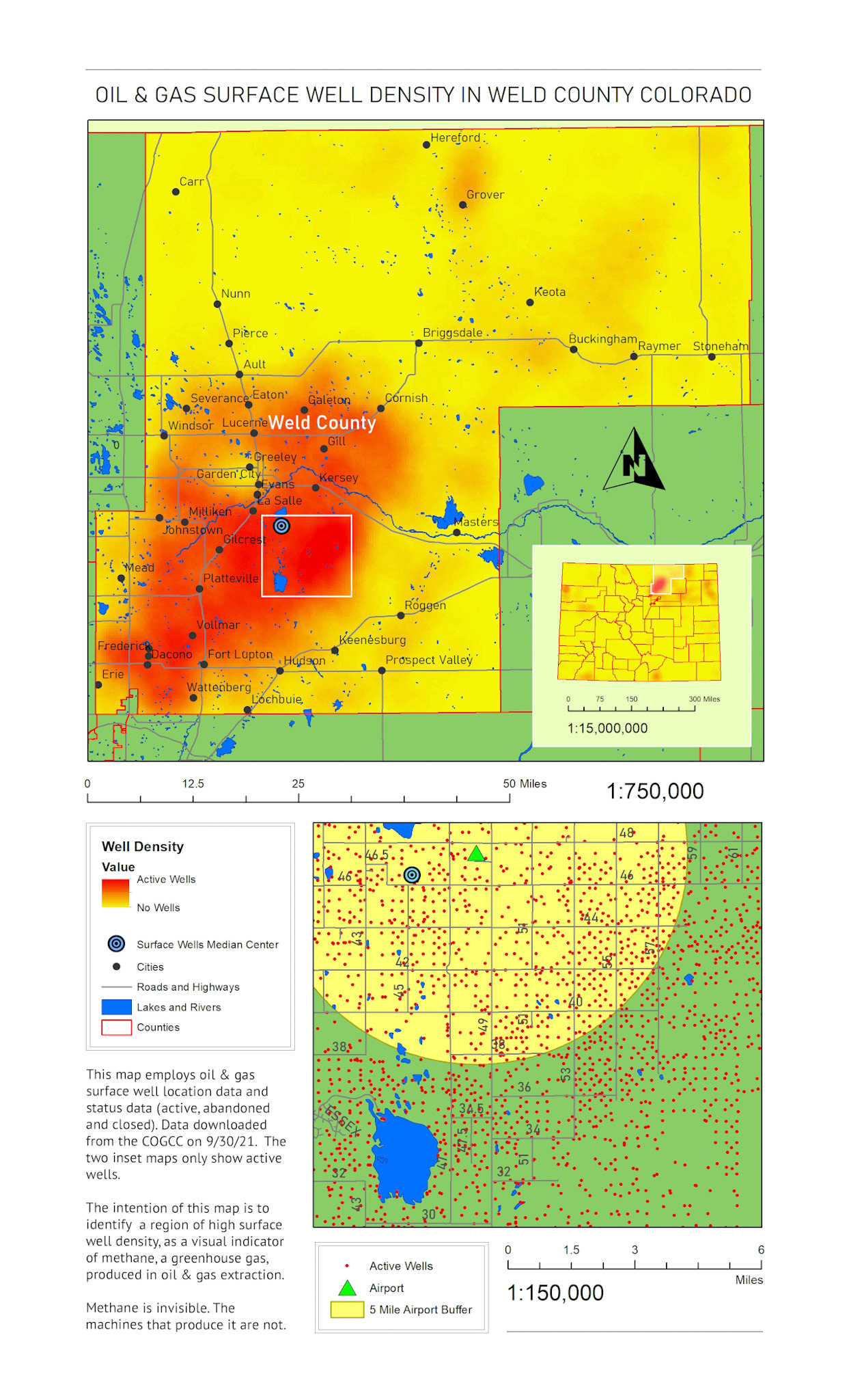

For my Lume Machina project I have a piece planned about anthropogenic climate change called “Don’t Stop”. It’s a 400’ high script that literally spells “Don’t Stop” that needs to be placed in a location of significance to be photographed. Methane, one of the leading greenhouse gases contributing to anthropogenic climate change, is invisible and can’t be photographed.
I need to identify a large area of methane production as a visual ‘stand-in’ for the methane, that’s close to home in Colorado.
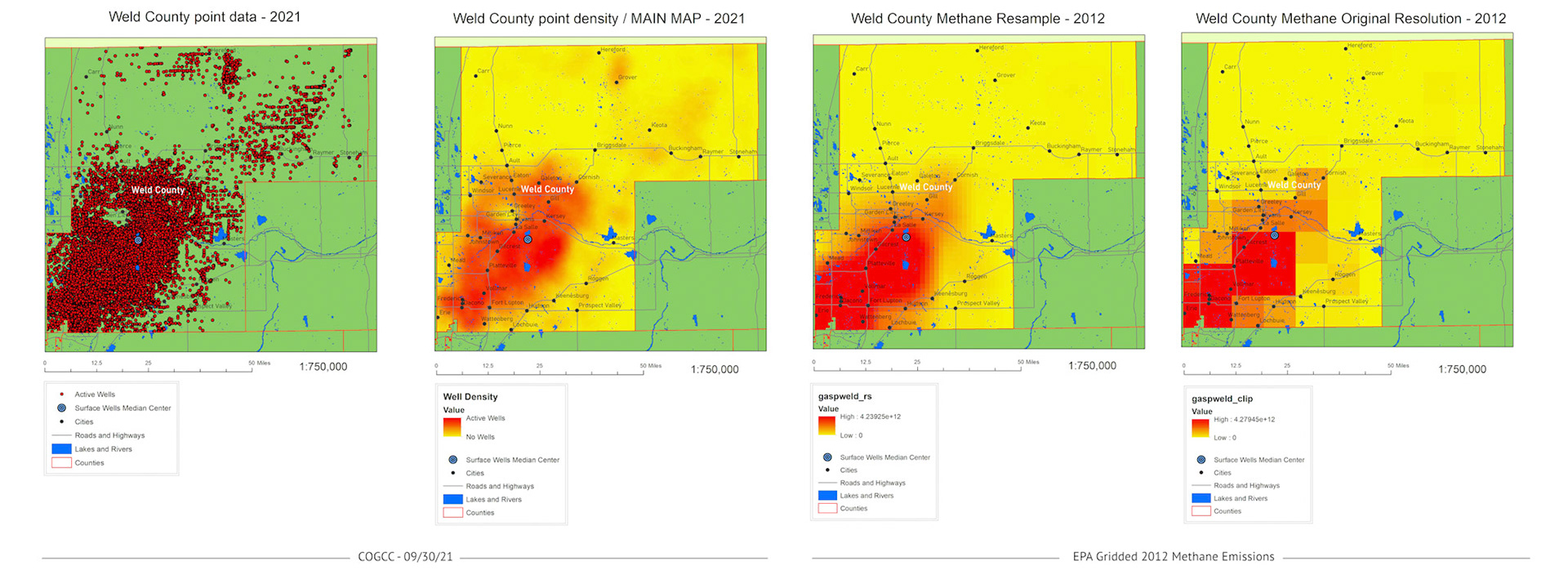
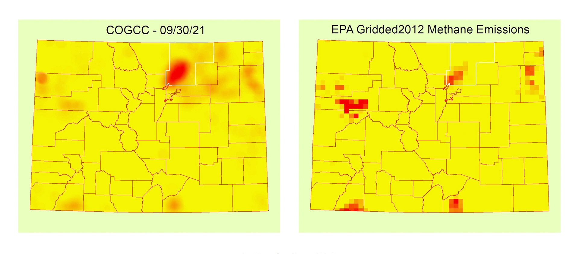
Regional (local to Colorado) methane data is difficult to find. Though nationwide and global methane data was easier to access, the scale of that data did not have the local resolution needed for regional analysis. Surface wells extracting natural gas (fracking) is a known methane producer, so as a proxy to actual regional methane data, I acquired statewide surface well data from the Colorado Oil and Gas Conservation Commission (GOGCC).
The statewide dataset, a point layer, has the location and status of every surface well in Colorado, and is supposedly updated daily. I downloaded my working dataset on 09/30/21.